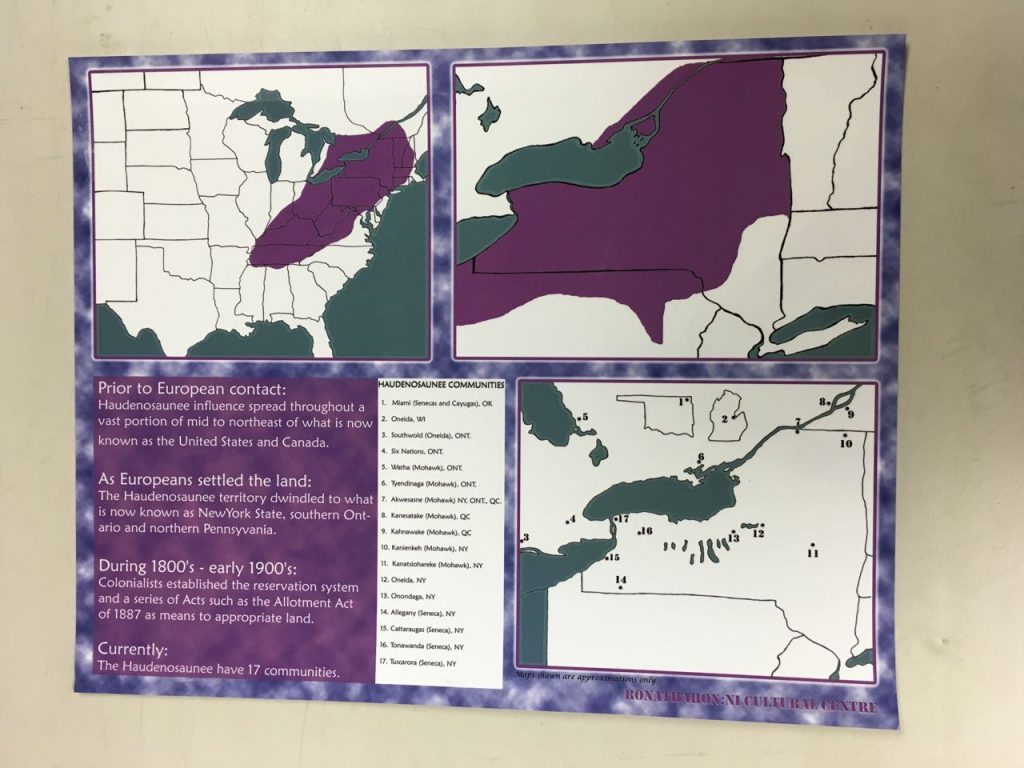
This map shows a brief history of the changing amount of territory held by Haudenosaunee Communities today and gives a brief overview of the history. Prior to European Contact the area covered the northern mid-east and eastern part of what is now known as the US and a bit of lower Canada. In the 17th century as Europeans settled the area encompassed NY State, Northern Pennsylvania and southern Ontario. During the 1800- early 1900s the Allotment Act established the reservation system which continues today. Nowadays there are 17 communities in what are know today as NY state, Ontario, Quebec, Wisconsin and Oklahoma. Maps shown in this image are approxiamte only and published by Ronathahon: NI Cultural Centre.
